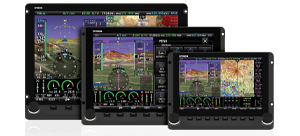
Regional High Resolution Basemap / Cultural Data
These databases were updated June 2013 to fix anomalies near the edges of their regions. No new content was added.
Changes (6/2013): Some roads, rivers, and railroads were inadvertantly left out near the edges of base map database regions.
Click on a link below to start downloading base map data. Mouse over a region link to view the section of the world the region covers.
Base map data files are not very large. They are approximately 10-20 MB each.
To import a base map file into your SkyView display, transfer the downloaded terrain file to a USB memory stick (a 4GB drive is included with every SkyView display). Insert the memory stick into any of the 3 USB ports on the display. Navigate to the SETUP > SYSTEM SOFTWARE > LOAD FILES menu, and select the terrain .dup file.
If you are running software version SkyView 5.0 or later, and have your displays connected via Ethernet, you only need to load this database onto one display: it will synchonize to all other displays via Ethernet. If you have SkyView 4.0 or earlier, or don't have your displays connected via Ethernet, you must load this file on all displays individually.

Regional High Resolution Terrain
Click on a link below to start downloading terrain data. Mouse over a region link to view the section of the world the region covers. You may either click the link to download via your browser (Internet Explorer, Firefox,or Chrome ONLY, Safari will not work), or connect to ftp://ftp.dynonavionics.com with an FTP client (such as Filezilla) to download the files with resume capability.
Terrain data files are about 2.5GB and will take a significant time to download. On a 10Mbit/s connection, you can expect one file to download in about 1 hour.
To import a terrain file into your SkyView display, transfer the downloaded terrain file to a USB memory stick (a 4GB drive is included with every SkyView display). Insert the memory stick into any of the 3 USB ports on the display. Navigate to the SETUP > SYSTEM SOFTWARE > LOAD FILES menu, and select the terrain .dup file. This database must be loaded individually on each SkyView display in your aircraft. Since these files are subtantial in size, they will take some time to load onto your display(s). Ensure that your SkyView display is connected to an external power source that can provide 30-60 minutes of power. We suggest that you do not rely on SkyView's backup battery for power during this update.
Note that the next time you power on SkyView after loading high resolution terrain, your display might take up to two minutes longer to power on than normal. This is expected and will only occur once.

Worldwide Low Resolution Terrain
SkyView uses a second, lower resolution terrain database of the entire world to augment the regional high resolution databases. This database is installed at the factory, but it can be manually deleted. If that has accidentally occurred, you will not see terrain when zoomed out. It can be downloaded for re-installation into your SkyView display here.
Low Resolution Terrain comes pre-loaded on all SkyView displays. If it is accidentally removed, it can be downloaded here. This database must be loaded individually on each SkyView display in your aircraft.
SkyView Low-Res Terrain Database
Released 12/4/2009 | Updated 9/3/2014
DOWNLOAD
Very Low Resolution Terrain - Worldwide:
The below file is pre-installed on SkyView displays. If it is accidentally removed, it can be downloaded here. This database must be loaded individually on each SkyView display in your aircraft.
SkyView Very Low-Res Terrain Database
Released 3/21/201 | Updated 9/3/2014
DOWNLOAD


 Proudly built in the U.S.A.