Geo-Referenced Charts and Airport Diagrams for Australia / New Zealand from AvPlan EFB
AvPlan EFB offers en-route charts for both Australia and New Zealand. It also offers a variety of procedure charts for each country as detailed below.

The AvPlan EFB Australian Data Subscription includes the MegaVFR chart combining all all WAC, VTC and VNC charts for Australia. The Mega En Route Low chart combines the ERC Low charts, and embedded TAC charts for Australia are also included.
Additionally the complete DAP East & West is available, all with geo-referenced airport diagrams and instrument approach procedures.
The New Zealand data subscription includes the New Zealand VNC chart and geo-referenced airport diagrams and instrument approach procedures from AIP Volumes 2-4.
A subscription to this service enables you to use the charts in a single aircraft for 1 year, and includes a free update service for the life of the subscription. A subscription is valid for 1 aircraft only and the data is usable only for the life of the subscription.
Subscriptions are available from the
AvPlan EFB website for the low price of $149 AUD for the Australian data or $169 NZD for the New Zealand data.
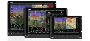
Using charts on your SkyView system
After you have installed chart data to your USB memory sticks, simply connect them to your SkyView display(s) to enable charting capabilities. The USB memory stick(s) must be left connected to your SkyView display(s) during normal use for charts to be available.
Charts that are related to airports, such as approach charts, procedures, airport diagrams, and similar can be found under the CHARTS tab of the airport INFO page.
Enroute-charts suych as sectionals, ICAO charts, and IFR LO/HI (products vary by region) can be overlaid on SkyView by going to MAP > LAYERS, and then selecting the layer you would like to see.


 Proudly built in the U.S.A.