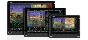
Geo-Referenced Charts and Airport Diagrams for Europe
European Charts are available from PocketFMS. Support for European procedure charts and airport diagrams was added to SkyView in version 7.1, with support for en-route charts added in 13.0. The data sets vary from country to country. In addition to charts and airport diagrams, the visual approach, landing, and area charts critical to flight in Europe are available for many countries. We also encourage you to contact PocketFMS directly to best understand what exact charts are offered in your area.
PocketFMS European Charts via Frequent Flyer Subscription
To provide chart data in Europe, Dynon Avionics has partnered with PocketFMS. To purchase chart data, go to
Pocket FMS and purchase a Frequent Flyer membership.
Frequent Flyer membership, which includes AeroData, charts (including Pooleys in the UK), airport diagrams, and visual approach, landing, and area charts, costs €150 per year. This is only €31 more than the existing SkyView AeroData-only subscription (which remains available).
Note that neither German DFS charts nor Swiss SkyGuide VFR Plates are included in this price, but they are available at additional cost.
Once you have registered and paid for your Frequent Flyer membership, you will have a registered email address and a registration number. Record this information in a safe place as you will need it to “unlock” the EasyVFR PC application used to download charts.
After you’ve purchased a PocketFMS Frequent Flyer Membership, the PocketFMS EasyVFR application for PC can be downloaded from
Pocket FMS.
A tutorial on how to use EasyVFR is available from Dynon Avionics
here.
Also, PocketFMS has their own tutorials available along the left side of their website ("Dataset Installation" and "Plates Installation")
Technical support is also available from
PocketFMS directly.
Using charts on your SkyView system
After you have installed chart data to your USB memory sticks, simply connect them to your SkyView display(s) to enable charting capabilities. The USB memory stick(s) must be left connected to your SkyView display(s) during normal use for charts to be available.
Charts that are related to airports, such as approach charts, procedures, airport diagrams, and similar can be found under the CHARTS tab of the airport INFO page.
Enroute-charts suych as sectionals, ICAO charts, and IFR LO/HI (products vary by region) can be overlaid on SkyView by going to MAP > LAYERS, and then selecting the layer you would like to see.


 Proudly built in the U.S.A.